Podcast Episodes
Back to SearchWhen Metadata Isn’t Enough: Extrinsic Quality Assessment of OSM Using Custom Reference Data (sotm2025)
This talk explores the extrinsic quality of OpenStreetMap data in Brno by comparing the city’s most frequently mapped amenities against a custom, fie…
1 year, 1 month ago

When Metadata Isn’t Enough: Extrinsic Quality Assessment of OSM Using Custom Reference Data (sotm2025)
This talk explores the extrinsic quality of OpenStreetMap data in Brno by comparing the city’s most frequently mapped amenities against a custom, fie…
1 year, 1 month ago
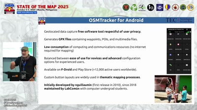
Keeping alive OSMTracker (sotm2025)
This is a story about the last 7 years of OSMTracker and how, from an academic space in a Costa Rican public university, we managed to keep alive the…
1 year, 1 month ago
OSMlanduse: A dataset of European Union land use at 10 m resolution derived from OpenStreetMap and Sentinel-2 (sotm2025)
OSMlanduse is the first EU-wide 10 m land-use map integrating 3.2 million OpenStreetMap geometries with Sentinel-2 imagery through an open deep-learn…
1 year, 1 month ago
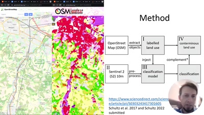
OSMlanduse: A dataset of European Union land use at 10 m resolution derived from OpenStreetMap and Sentinel-2 (sotm2025)
OSMlanduse is the first EU-wide 10 m land-use map integrating 3.2 million OpenStreetMap geometries with Sentinel-2 imagery through an open deep-learn…
1 year, 1 month ago
Leveraging OpenStreetMap for hyperlocal geocoding of Twitter data: A spatiotemporal analysis of the 2016 Haifa (Israel) wildfire (sotm2025)
This study presents a geospatial framework that combines NLP, machine learning, and GIScience to extract and georeference tweets related to the Novem…
1 year, 1 month ago
Walking Milano: Unveiling the City’s Character Through 360° Street-Level Panorama Imagery. (sotm2025)
Between September 2024 and August 2025, we conducted a comprehensive street-level survey of Milano, Italy, capturing approximately one million 360° p…
1 year, 1 month ago
PlaceCrafter: Curating Urban Functional Regions through Platial Clustering of OpenStreetMap Points of Interest (sotm2025)
The world is not just made of streets, buildings, and zones; it is shaped by how people engage and interact with places in their everyday lives. This…
1 year, 1 month ago

PlaceCrafter: Curating Urban Functional Regions through Platial Clustering of OpenStreetMap Points of Interest (sotm2025)
The world is not just made of streets, buildings, and zones; it is shaped by how people engage and interact with places in their everyday lives. This…
1 year, 1 month ago