Episode Details
Back to Episodes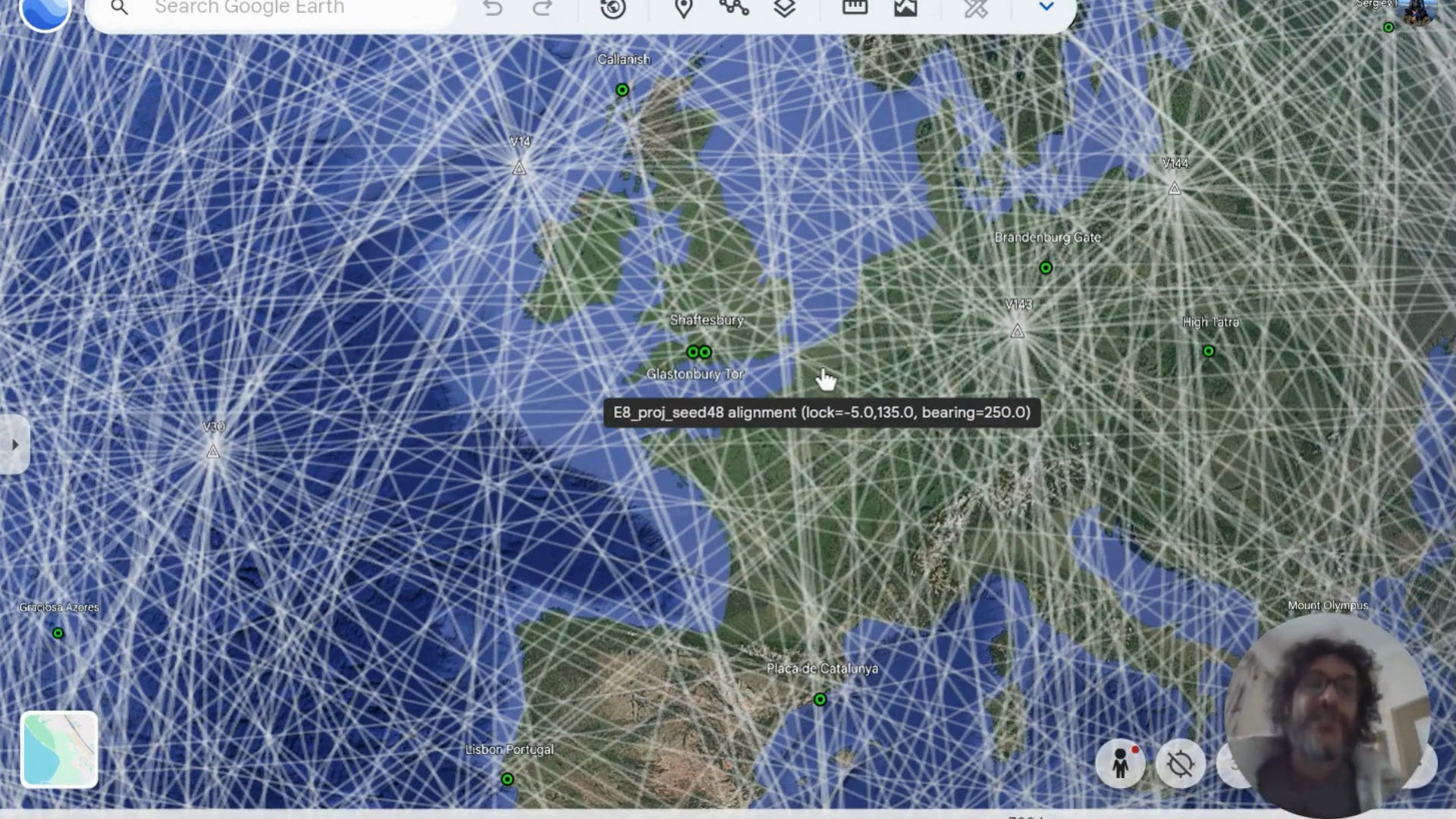
The E8 Earth Grid: Seed 48 — An Exceptional Core Density
Description
Do sacred sites align with higher-dimensional geometry?
Replication is the gold standard of evidence. A single alignment, however compelling, could always be written off as a cosmic accident. Two independent alignments, each surviving search-bias correction, each achieving p = 0.005; that’s a different story entirely.
This is Seed 48: a completely new projection of the E8 lattice onto the Earth, optimised without reference to the first. Its orientation is nearly antipodal to Seed 3: 5° South, 135° East, rather than 65° North, 125° East. Its statistical strength lies in precision rather than coverage. And its edges connect sites that Seed 3 never touched.
What follows are three layers of evidence from this second projection. The mathematics remains the same. The data remains the same. Only the geometry has changed, and yet the alignment persists.
Layer 1: Full Network (6,720 edges, all sites coloured by proximity)
This is our second significant E8 projection, Seed 48, a completely different way of folding the same eight-dimensional lattice onto the Earth. Where Seed 3 was oriented at 65° North, 125° East, this one locks at 5° South, 135° East; nearly antipodal. Yet it produces its own statistically significant alignment. You’re looking at all 6,720 E8 edges with the 160 sacred sites coloured by proximity: green within 5.5 kilometres, yellow up to 17 kilometres, red beyond. 83% of all sites, 133 out of 160, fall within just 0.05 degrees, about 5.6 kilometres, of an E8 edge. That means, if you randomly rotated this grid 200 times and optimised each one, only about 5 of those 200 trials would match what you see here. That fraction is significant at p = 0.005; only 1 in 200 search-optimised random trials could match it. What’s remarkable is that this is a tighter threshold than Seed 3. Seed 3’s strength was breadth, 97% of sites within 11 kilometres. Seed 48’s strength is density, packing more sites into the ultra-close core.
Layer 2: Supported Edges (198 edges within 0.05° of at least one site)
Now I’m filtering to show only the 198 edges that pass within 5.6 kilometres of a site. That’s just 3% of the full lattice, yet these edges account for 133 sacred sites. Notice the distribution of connectivity: Golden Hinde in British Columbia and Cerro de la Silla in Mexico each sit near 6 edges; they’re major nodes in this projection. Mount Damavand in Iran and St. Helena Island in the South Atlantic each have 5 edges. Compare this with Seed 3, where Mecca and Isangila Falls were the top nodes. Different projections, different hubs, but the same underlying mathematical structure that produces the alignment.
Layer 3: Shared Edges — the Ley Lines (7 edges connecting 2+ sites)
These seven edges are the connections that matter most; each one passes within 5.6 kilometres of two or more sacred sites at the same time. Some of these pairings echo across both projections. The Easter Island cluster, Easter Island, Rano Aroi, and Rano Koi share an edge here, just as they did in Seed 3.